
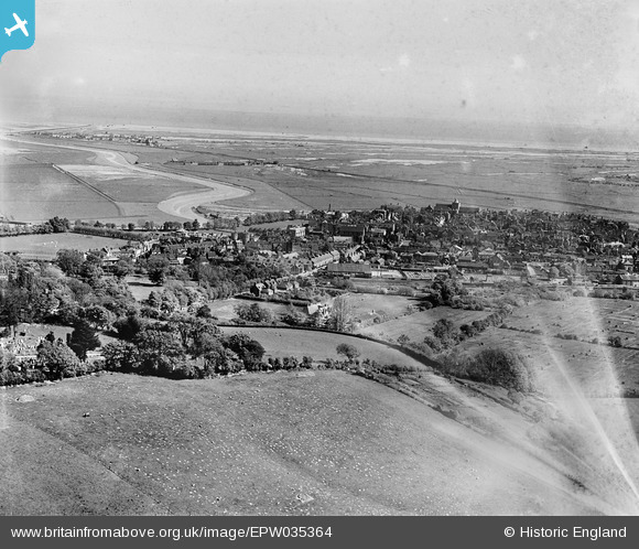
EPW035364 ENGLAND (1931). The town, Rye, from the north-west, 1931
© Copyright OpenStreetMap contributors and licensed by the OpenStreetMap Foundation. 2026. Cartography is licensed as CC BY-SA.
Nearby Images (2)
EPW035364

EPW039357

Details
| Title | [EPW035364] The town, Rye, from the north-west, 1931 |
| Reference | EPW035364 |
| Date | 25-May-1931 |
| Link | |
| Place name | RYE |
| Parish | RYE |
| District | |
| Country | ENGLAND |
| Easting / Northing | 591899, 120985 |
| Longitude / Latitude | 0.73266539712692, 50.955749129464 |
| National Grid Reference | TQ919210 |
Pins

glennhughz |
Thursday 10th of April 2014 10:19:50 AM | |

Class31 |
Thursday 24th of January 2013 10:05:50 PM |