
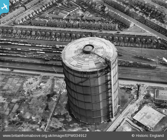
EPW034912 ENGLAND (1931). The Southall Gasometer opposite Queen's Road, Southall, 1931
© Copyright OpenStreetMap contributors and licensed by the OpenStreetMap Foundation. 2026. Cartography is licensed as CC BY-SA.
Nearby Images (2)
EPW034912

EPW034913

Details
| Title | [EPW034912] The Southall Gasometer opposite Queen's Road, Southall, 1931 |
| Reference | EPW034912 |
| Date | March-1931 |
| Link | |
| Place name | SOUTHALL |
| Parish | |
| District | |
| Country | ENGLAND |
| Easting / Northing | 511919, 179716 |
| Longitude / Latitude | -0.38725840954318, 51.504797966016 |
| National Grid Reference | TQ119797 |
Pins

southallboy |
Tuesday 5th of February 2013 04:49:11 PM | |
|
southallboy |
Tuesday 5th of February 2013 04:42:07 PM | |
|
southallboy |
Tuesday 5th of February 2013 04:40:56 PM |