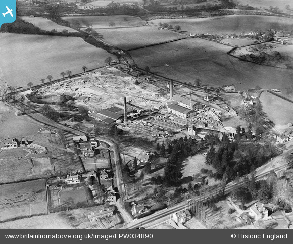
EPW034890 ENGLAND (1931). H.F. Warner Star Works (Brick and Tile), Knowl, Hill, 1931
© Copyright OpenStreetMap contributors and licensed by the OpenStreetMap Foundation. 2025. Cartography is licensed as CC BY-SA.
Nearby Images (7)
Details
| Title | [EPW034890] H.F. Warner Star Works (Brick and Tile), Knowl, Hill, 1931 |
| Reference | EPW034890 |
| Date | March-1931 |
| Link | |
| Place name | KNOWL HILL |
| Parish | WARGRAVE |
| District | |
| Country | ENGLAND |
| Easting / Northing | 481973, 179469 |
| Longitude / Latitude | -0.81871802844884, 51.507715996566 |
| National Grid Reference | SU820795 |
Pins
Be the first to add a comment to this image!


![[EPW034890] H.F. Warner Star Works (Brick and Tile), Knowl, Hill, 1931](http://britainfromabove.org.uk/sites/all/libraries/aerofilms-images/public/100x100/EPW/034/EPW034890.jpg)
![[EPW034886] H.F. Warner Star Works (Brick and Tile), Knowl, Hill, 1931](http://britainfromabove.org.uk/sites/all/libraries/aerofilms-images/public/100x100/EPW/034/EPW034886.jpg)
![[EPW034887] H.F. Warner Star Works (Brick and Tile), Knowl, Hill, 1931](http://britainfromabove.org.uk/sites/all/libraries/aerofilms-images/public/100x100/EPW/034/EPW034887.jpg)
![[EPW034888] H.F. Warner Star Works (Brick and Tile) and environs, Knowl, Hill, 1931](http://britainfromabove.org.uk/sites/all/libraries/aerofilms-images/public/100x100/EPW/034/EPW034888.jpg)
![[EPW034891] H.F. Warner Star Works (Brick and Tile), Knowl, Hill, 1931](http://britainfromabove.org.uk/sites/all/libraries/aerofilms-images/public/100x100/EPW/034/EPW034891.jpg)
![[EPW034889] H.F. Warner Star Works (Brick and Tile), Knowl, Hill, 1931](http://britainfromabove.org.uk/sites/all/libraries/aerofilms-images/public/100x100/EPW/034/EPW034889.jpg)
![[EPW034894] H.F. Warner Star Works (Brick and Tile) and environs, Knowl, Hill, 1931](http://britainfromabove.org.uk/sites/all/libraries/aerofilms-images/public/100x100/EPW/034/EPW034894.jpg)