
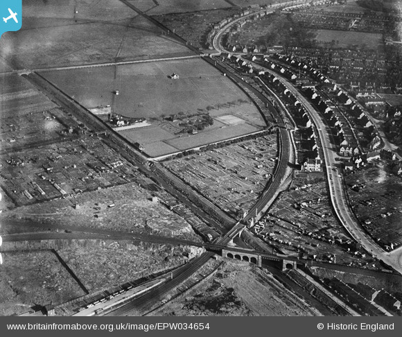
EPW034654 ENGLAND (1930). Reckitt's Recreation Ground, Kingston upon Hull, 1930
© Copyright OpenStreetMap contributors and licensed by the OpenStreetMap Foundation. 2026. Cartography is licensed as CC BY-SA.
Nearby Images (4)
EPW034654

EPW034659

EPW034647

EPW034658

Details
| Title | [EPW034654] Reckitt's Recreation Ground, Kingston upon Hull, 1930 |
| Reference | EPW034654 |
| Date | 16-October-1930 |
| Link | |
| Place name | KINGSTON UPON HULL |
| Parish | |
| District | |
| Country | ENGLAND |
| Easting / Northing | 510742, 430666 |
| Longitude / Latitude | -0.31995946480206, 53.760343825076 |
| National Grid Reference | TA107307 |
Pins

petepie08 |
Monday 19th of October 2020 05:32:42 PM | |
|
John Wass |
Monday 25th of May 2015 04:21:07 PM | |
|
HullPaul |
Wednesday 6th of August 2014 07:39:29 PM | |
The 1910 map marks it as being to the west of the drain. |
John Wass |
Monday 25th of May 2015 04:22:46 PM |
|
CartoonHead |
Sunday 21st of July 2013 10:15:56 AM | |
Sorry to disagree but this is not the line to Withernsea. That branches off at the eastern end of Wilmington station and crosses the Holderness Drain a little further south and certainly on the level not on an embankment as this one does. |
John Wass |
Wednesday 25th of June 2014 03:45:28 PM |
Agree with the previous disagreement The flag actually marks the Hull & Barnsley high level line to Alexandra Dock. |
PaulT |
Saturday 27th of December 2014 04:37:08 PM |
|
CartoonHead |
Sunday 21st of July 2013 10:10:30 AM | |
|
CartoonHead |
Sunday 21st of July 2013 10:04:31 AM | |
|
CartoonHead |
Sunday 21st of July 2013 09:32:46 AM | |
|
CartoonHead |
Sunday 21st of July 2013 09:31:10 AM |