
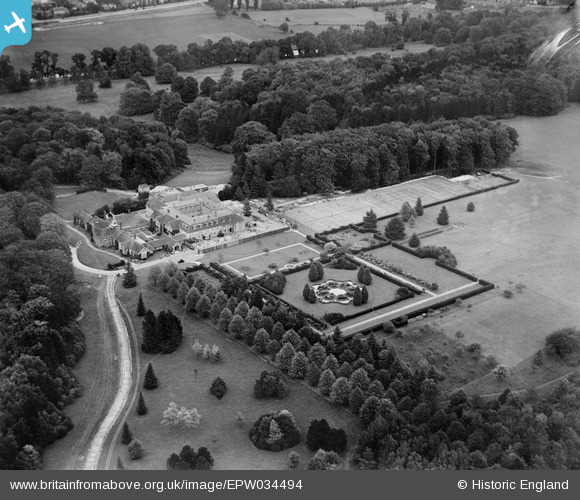
EPW034494 ENGLAND (1930). Daws Hill House and Grounds, High Wycombe, 1930
© Copyright OpenStreetMap contributors and licensed by the OpenStreetMap Foundation. 2026. Cartography is licensed as CC BY-SA.
Nearby Images (11)
EPW034494

EAW024277

EPW034493

EPW034497

EPW034488

EPW034487

EPW034490

EAW024276

EPW034489

EPW034495

EAW024275

Details
| Title | [EPW034494] Daws Hill House and Grounds, High Wycombe, 1930 |
| Reference | EPW034494 |
| Date | August-1930 |
| Link | |
| Place name | HIGH WYCOMBE |
| Parish | |
| District | |
| Country | ENGLAND |
| Easting / Northing | 486605, 191977 |
| Longitude / Latitude | -0.74890200628881, 51.61947519765 |
| National Grid Reference | SU866920 |
Pins
Be the first to add a comment to this image!