
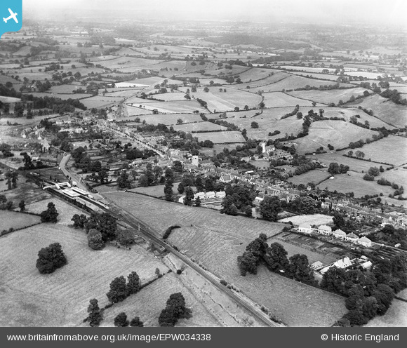
EPW034338 ENGLAND (1930). The town, Henley-in-Arden, from the south-west, 1930
© Copyright OpenStreetMap contributors and licensed by the OpenStreetMap Foundation. 2026. Cartography is licensed as CC BY-SA.
Nearby Images (2)
EPW034338

EPW034335

Details
| Title | [EPW034338] The town, Henley-in-Arden, from the south-west, 1930 |
| Reference | EPW034338 |
| Date | August-1930 |
| Link | |
| Place name | HENLEY-IN-ARDEN |
| Parish | HENLEY-IN-ARDEN |
| District | |
| Country | ENGLAND |
| Easting / Northing | 414840, 265706 |
| Longitude / Latitude | -1.7824083374358, 52.288897311621 |
| National Grid Reference | SP148657 |
Pins

clippedwings |
Thursday 12th of March 2015 09:36:17 PM | |
|
clippedwings |
Thursday 12th of March 2015 09:32:26 PM |