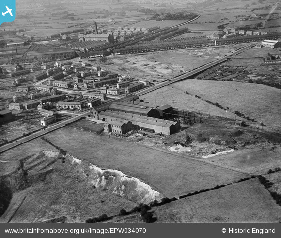
EPW034070 ENGLAND (1930). The Dick Lane Engineering Foundry and environs, Pudsey, 1930
    © Copyright OpenStreetMap contributors and licensed by the OpenStreetMap Foundation. 2025. Cartography is licensed as CC BY-SA.
  
Details
| Title | [EPW034070] The Dick Lane Engineering Foundry and environs, Pudsey, 1930 | 
| Reference | EPW034070 | 
| Date | July-1930 | 
| Link | |
| Place name | PUDSEY | 
| Parish | |
| District | |
| Country | ENGLAND | 
| Easting / Northing | 419537, 433571 | 
| Longitude / Latitude | -1.7033567096723, 53.797862885468 | 
| National Grid Reference | SE195336 | 
 
             
  ![[EPW034070] The Dick Lane Engineering Foundry and environs, Pudsey, 1930](http://britainfromabove.org.uk/sites/all/libraries/aerofilms-images/public/100x100/EPW/034/EPW034070.jpg) 
  
                                          ![[EPW034071] The Dick Lane Engineering Foundry and environs, Pudsey, 1930](http://britainfromabove.org.uk/sites/all/libraries/aerofilms-images/public/100x100/EPW/034/EPW034071.jpg) 
 ![[EPW034061] The Tramway Depot, Dick Lane Foundry and the Phoenix Engineering Works, Thornbury, from the south-east, 1930](http://britainfromabove.org.uk/sites/all/libraries/aerofilms-images/public/100x100/EPW/034/EPW034061.jpg) 
  Dick Lane
 Dick Lane