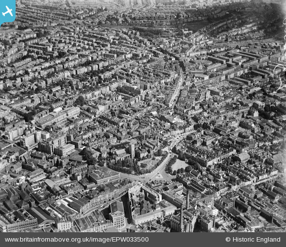
EPW033500 ENGLAND (1930). St James' Park and the city, Bristol, from the south-west, 1930
    © Copyright OpenStreetMap contributors and licensed by the OpenStreetMap Foundation. 2025. Cartography is licensed as CC BY-SA.
  
Nearby Images (19)
Details
| Title | [EPW033500] St James' Park and the city, Bristol, from the south-west, 1930 | 
| Reference | EPW033500 | 
| Date | July-1930 | 
| Link | |
| Place name | BRISTOL | 
| Parish | |
| District | |
| Country | ENGLAND | 
| Easting / Northing | 358912, 173342 | 
| Longitude / Latitude | -2.5914411728911, 51.457075170725 | 
| National Grid Reference | ST589733 | 
Pins
|  Tuckett's Buildings |   MildBunch | Wednesday 18th of February 2015 01:34:53 PM | 
|  King's Square |   MildBunch | Tuesday 17th of February 2015 01:29:23 PM | 
|  St James's Square. 1709-1968 |   MildBunch | Tuesday 17th of February 2015 01:27:39 PM | 
|  The Full Moon |   MildBunch | Tuesday 17th of February 2015 12:15:00 AM | 
|  Brunswick Square | Class31 | Thursday 12th of December 2013 03:42:54 PM | 
|  Montpelier Railway Station GWR | Class31 | Thursday 12th of December 2013 11:02:54 AM | 
|  Stokes Croft A38 | Class31 | Thursday 12th of December 2013 11:01:41 AM | 
|  Nelson Street |   MB | Thursday 17th of January 2013 04:55:07 PM | 
|  Police Court in 1918 |   MB | Thursday 17th of January 2013 04:54:49 PM | 
|  Union Street |   MB | Thursday 17th of January 2013 04:53:50 PM | 
|  Silver Street |   MB | Thursday 17th of January 2013 04:53:31 PM | 
|  Broad Mead - a tramway route. This area suffered a great deal in bombing raids in World War II and was rebuilt in the 1950s |   MB | Thursday 17th of January 2013 04:52:38 PM | 
|  Lower Union Street - a tramway route |   MB | Thursday 17th of January 2013 04:50:25 PM | 
|  Hay Market |   MB | Thursday 17th of January 2013 04:49:04 PM | 
|  Confectionery Works in 1918 |   MB | Thursday 17th of January 2013 04:48:29 PM | 
|  Lewins Mead |   MB | Thursday 17th of January 2013 04:48:04 PM | 
|  Brewery in 1918 |   MB | Thursday 17th of January 2013 04:47:25 PM | 
|  Rupert Street |   MB | Thursday 17th of January 2013 04:46:58 PM | 
|  Tramway depot |   MB | Thursday 17th of January 2013 04:46:03 PM | 
|  St James's Church |   MB | Thursday 17th of January 2013 04:45:27 PM | 
|  Lower Maudlin Street |   MB | Thursday 17th of January 2013 04:44:30 PM | 
|  Royal Infirmary |   MB | Thursday 17th of January 2013 04:44:05 PM | 
 
             
  ![[EPW033500] St James' Park and the city, Bristol, from the south-west, 1930](http://britainfromabove.org.uk/sites/all/libraries/aerofilms-images/public/100x100/EPW/033/EPW033500.jpg) 
  
                                          ![[EPW005422] Fry's Cocoa Manufactory on Union Street and environs, Bristol, 1921](http://britainfromabove.org.uk/sites/all/libraries/aerofilms-images/public/100x100/EPW/005/EPW005422.jpg) 
 ![[EPW005424] Fry's Cocoa Manufactory on Union Street and environs, Bristol, 1921](http://britainfromabove.org.uk/sites/all/libraries/aerofilms-images/public/100x100/EPW/005/EPW005424.jpg) 
 ![[EPW005425] Fry's Cocoa Manufactory on Union Street and environs, Bristol, 1921](http://britainfromabove.org.uk/sites/all/libraries/aerofilms-images/public/100x100/EPW/005/EPW005425.jpg) 
 ![[EPW005427] Fry's Cocoa Manufactory on Union Street and environs, Bristol, 1921](http://britainfromabove.org.uk/sites/all/libraries/aerofilms-images/public/100x100/EPW/005/EPW005427.jpg) 
 ![[EPW005419] Lewins Mead and environs, Bristol, 1921](http://britainfromabove.org.uk/sites/all/libraries/aerofilms-images/public/100x100/EPW/005/EPW005419.jpg) 
 ![[EPW005426] Fry's Cocoa Manufactory on Union Street and environs, Bristol, 1921](http://britainfromabove.org.uk/sites/all/libraries/aerofilms-images/public/100x100/EPW/005/EPW005426.jpg) 
 ![[EPW005421] Fry's Cocoa Manufactory on Union Street and environs, Bristol, 1921](http://britainfromabove.org.uk/sites/all/libraries/aerofilms-images/public/100x100/EPW/005/EPW005421.jpg) 
 ![[EPW005423] Fry's Cocoa Manufactory on Union Street and environs, Bristol, 1921](http://britainfromabove.org.uk/sites/all/libraries/aerofilms-images/public/100x100/EPW/005/EPW005423.jpg) 
 ![[EPW005420] Fry's Cocoa Manufactory on Union Street and environs, Bristol, 1921](http://britainfromabove.org.uk/sites/all/libraries/aerofilms-images/public/100x100/EPW/005/EPW005420.jpg) 
 ![[EPW005428] Rupert Street and environs, Bristol, 1921](http://britainfromabove.org.uk/sites/all/libraries/aerofilms-images/public/100x100/EPW/005/EPW005428.jpg) 
 ![[EPW060118] The city centre, Bristol, 1938](http://britainfromabove.org.uk/sites/all/libraries/aerofilms-images/public/100x100/EPW/060/EPW060118.jpg) 
 ![[EPW022277] The city, Bristol, from the east, 1928](http://britainfromabove.org.uk/sites/all/libraries/aerofilms-images/public/100x100/EPW/022/EPW022277.jpg) 
 ![[EAW050553] Broadmead and environs, Bristol, 1953](http://britainfromabove.org.uk/sites/all/libraries/aerofilms-images/public/100x100/EAW/050/EAW050553.jpg) 
 ![[EPW005431] Rupert Street and environs, Bristol, 1921](http://britainfromabove.org.uk/sites/all/libraries/aerofilms-images/public/100x100/EPW/005/EPW005431.jpg) 
 ![[EPW005432] Quay Street and environs, Bristol, 1921](http://britainfromabove.org.uk/sites/all/libraries/aerofilms-images/public/100x100/EPW/005/EPW005432.jpg) 
 ![[EPW005429] Quay Street and environs, Bristol, 1921](http://britainfromabove.org.uk/sites/all/libraries/aerofilms-images/public/100x100/EPW/005/EPW005429.jpg) 
 ![[EPW005430] Rupert Street and environs, Bristol, 1921](http://britainfromabove.org.uk/sites/all/libraries/aerofilms-images/public/100x100/EPW/005/EPW005430.jpg) 
 ![[EPW005477] King Edward VII Memorial Infirmary, Bristol, 1921](http://britainfromabove.org.uk/sites/all/libraries/aerofilms-images/public/100x100/EPW/005/EPW005477.jpg)