
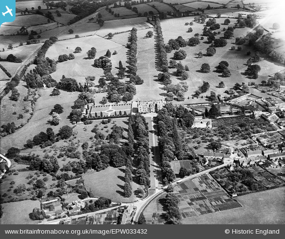
EPW033432 ENGLAND (1930). Montacute House and Park, Montacute, 1930
© Copyright OpenStreetMap contributors and licensed by the OpenStreetMap Foundation. 2026. Cartography is licensed as CC BY-SA.
Nearby Images (14)
EPW033432

EPW033429

EPW033428

EAW015046

EPW033431

EAW015047

EPW024013

EAW015044

EPW024012

EPW033433

EAW015043

EPW033430

EAW015045

EPW024014

Details
| Title | [EPW033432] Montacute House and Park, Montacute, 1930 |
| Reference | EPW033432 |
| Date | July-1930 |
| Link | |
| Place name | MONTACUTE |
| Parish | MONTACUTE |
| District | |
| Country | ENGLAND |
| Easting / Northing | 349941, 117189 |
| Longitude / Latitude | -2.7127281418752, 50.951410470038 |
| National Grid Reference | ST499172 |
Pins

MB |
Friday 29th of March 2013 06:26:22 PM | |
|
MB |
Friday 29th of March 2013 06:26:00 PM | |
|
MB |
Friday 29th of March 2013 06:24:26 PM | |
|
MB |
Friday 29th of March 2013 06:20:03 PM | |
|
MB |
Friday 29th of March 2013 06:15:39 PM |
User Comment Contributions
A fair amount of detail on the house and gardens on the Wikipedia website here: en.wikipedia.org/wiki/Montacute_House |
MB |
Friday 29th of March 2013 06:27:27 PM |
Montacute House was built in about the year 1598 and is one of the country's finest examples of late Elizabethan architecture. It is listed Grade I |
MB |
Friday 29th of March 2013 06:17:46 PM |