
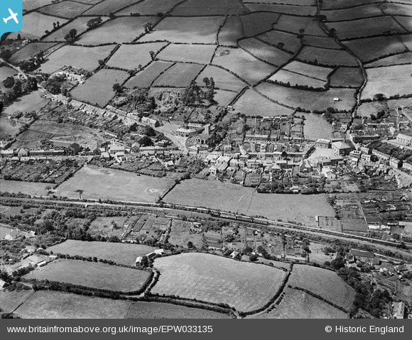
EPW033135 ENGLAND (1930). St Blaise's Church, the town and surrounding countryside, St Blazey, 1930
© Copyright OpenStreetMap contributors and licensed by the OpenStreetMap Foundation. 2026. Cartography is licensed as CC BY-SA.
Nearby Images (3)
EPW033135

EPW033134

EPW033132

Details
| Title | [EPW033135] St Blaise's Church, the town and surrounding countryside, St Blazey, 1930 |
| Reference | EPW033135 |
| Date | July-1930 |
| Link | |
| Place name | ST BLAZEY |
| Parish | ST. BLAISE |
| District | |
| Country | ENGLAND |
| Easting / Northing | 206918, 54854 |
| Longitude / Latitude | -4.7149957666764, 50.361261500719 |
| National Grid Reference | SX069549 |
Pins

Bristolian |
Tuesday 23rd of July 2013 01:27:09 PM |