
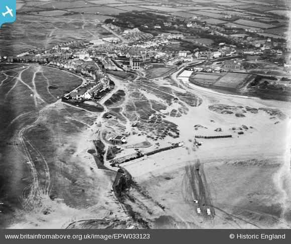
EPW033123 ENGLAND (1930). Summerleaze Point and the town, Bude, 1930
© Copyright OpenStreetMap contributors and licensed by the OpenStreetMap Foundation. 2026. Cartography is licensed as CC BY-SA.
Nearby Images (3)
EPW033123

EPW039884

EPW039885

Details
| Title | [EPW033123] Summerleaze Point and the town, Bude, 1930 |
| Reference | EPW033123 |
| Date | July-1930 |
| Link | |
| Place name | BUDE |
| Parish | BUDE-STRATTON |
| District | |
| Country | ENGLAND |
| Easting / Northing | 220497, 106637 |
| Longitude / Latitude | -4.5492870653829, 50.830834441349 |
| National Grid Reference | SS205066 |
Pins
Be the first to add a comment to this image!