
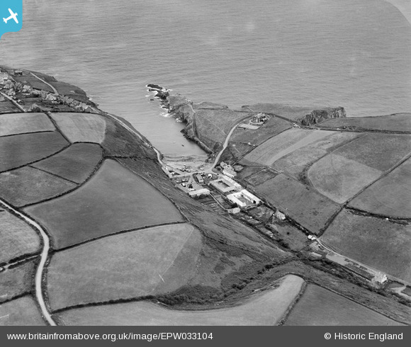
EPW033104 ENGLAND (1930). The hamlet of Port Gaverne and environs, Port Gaverne, 1930
© Copyright OpenStreetMap contributors and licensed by the OpenStreetMap Foundation. 2026. Cartography is licensed as CC BY-SA.
Nearby Images (2)
EPW033104

EPW033103

Details
| Title | [EPW033104] The hamlet of Port Gaverne and environs, Port Gaverne, 1930 |
| Reference | EPW033104 |
| Date | July-1930 |
| Link | |
| Place name | PORT GAVERNE |
| Parish | ST. ENDELLION |
| District | |
| Country | ENGLAND |
| Easting / Northing | 200298, 80848 |
| Longitude / Latitude | -4.8218435794341, 50.592562342057 |
| National Grid Reference | SX003808 |
Pins

foster |
Friday 15th of June 2018 07:49:11 PM |