
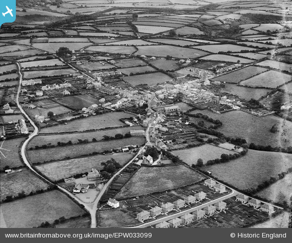
EPW033099 ENGLAND (1930). The village and environs, Bere Alston, 1930
© Copyright OpenStreetMap contributors and licensed by the OpenStreetMap Foundation. 2026. Cartography is licensed as CC BY-SA.
Nearby Images (4)
EPW033099

EPW033098

EPW033100

EPW033101

Details
| Title | [EPW033099] The village and environs, Bere Alston, 1930 |
| Reference | EPW033099 |
| Date | July-1930 |
| Link | |
| Place name | BERE ALSTON |
| Parish | BERE FERRERS |
| District | |
| Country | ENGLAND |
| Easting / Northing | 244629, 66841 |
| Longitude / Latitude | -4.1901532310841, 50.480162872912 |
| National Grid Reference | SX446668 |
Pins

TLeverton@aol.com |
Wednesday 11th of September 2013 12:53:19 PM | |
|
TLeverton@aol.com |
Wednesday 11th of September 2013 12:52:50 PM | |
|
TLeverton@aol.com |
Wednesday 11th of September 2013 12:52:07 PM |