
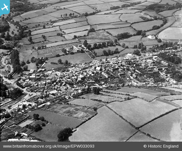
EPW033093 ENGLAND (1930). The town and surrounding countryside, Kingsbridge, 1930
© Copyright OpenStreetMap contributors and licensed by the OpenStreetMap Foundation. 2025. Cartography is licensed as CC BY-SA.
Nearby Images (9)
EPW033093

EPW033144

EPW033091

EPW023757

EPW023754

EPW023750

EPW033092

EPW023751

EPW023758

Details
| Title | [EPW033093] The town and surrounding countryside, Kingsbridge, 1930 |
| Reference | EPW033093 |
| Date | July-1930 |
| Link | |
| Place name | KINGSBRIDGE |
| Parish | KINGSBRIDGE |
| District | |
| Country | ENGLAND |
| Easting / Northing | 273469, 44321 |
| Longitude / Latitude | -3.7762690661206, 50.284648943934 |
| National Grid Reference | SX735443 |
Pins
Be the first to add a comment to this image!