
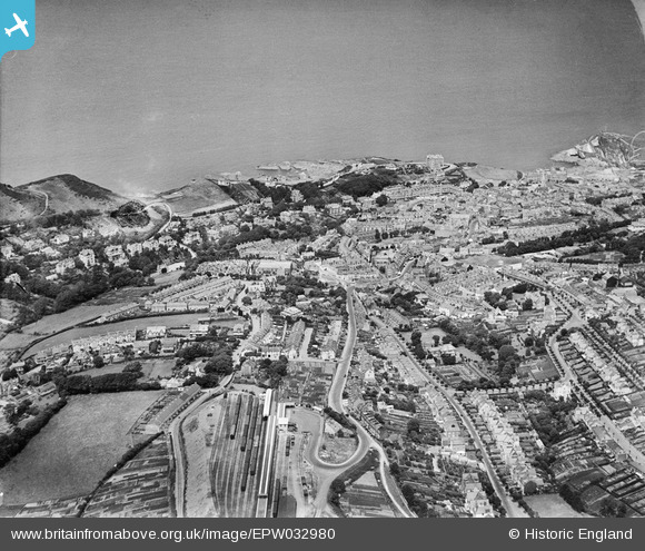
EPW032980 ENGLAND (1930). The railway terminus and the town, Ilfracombe, from the south, 1930
© Copyright OpenStreetMap contributors and licensed by the OpenStreetMap Foundation. 2026. Cartography is licensed as CC BY-SA.
Nearby Images (2)
EPW032980

EPW032987

Details
| Title | [EPW032980] The railway terminus and the town, Ilfracombe, from the south, 1930 |
| Reference | EPW032980 |
| Date | July-1930 |
| Link | |
| Place name | ILFRACOMBE |
| Parish | ILFRACOMBE |
| District | |
| Country | ENGLAND |
| Easting / Northing | 251468, 147002 |
| Longitude / Latitude | -4.1263275885496, 51.202376660111 |
| National Grid Reference | SS515470 |
Pins

Louis |
Saturday 1st of November 2014 05:21:58 PM | |
Originally opened in 1874 by the London and South-Western Railway, merged with others to form the Southern Railway in the 1923 'Grouping'. Closed by British Railways in 1970. A preservation group attempted to save the line but were not successful. The history of the station and the line can be found at http://www.disused-stations.org.uk/i/ilfracombe/index.shtml with photos of the station before and after closure. |
John W |
Monday 27th of February 2017 04:57:36 PM |