
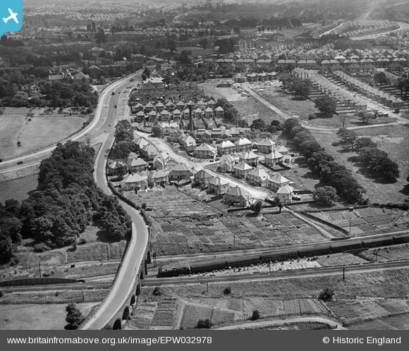
EPW032978 ENGLAND (1930). Endersleigh Gardens and Watford Way, Hendon, 1930
© Copyright OpenStreetMap contributors and licensed by the OpenStreetMap Foundation. 2026. Cartography is licensed as CC BY-SA.
Nearby Images (10)
EPW032978

EPW032979

EPW032972

EPW032974

EPW032976

EPW032977

EPW032973

EPW006779

EAW020704

EPW032975

Details
| Title | [EPW032978] Endersleigh Gardens and Watford Way, Hendon, 1930 |
| Reference | EPW032978 |
| Date | June-1930 |
| Link | |
| Place name | HENDON |
| Parish | |
| District | |
| Country | ENGLAND |
| Easting / Northing | 522272, 189059 |
| Longitude / Latitude | -0.23489819608403, 51.586629027013 |
| National Grid Reference | TQ223891 |
Pins

ken |
Monday 19th of October 2015 09:36:49 PM |