
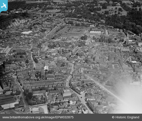
EPW032875 ENGLAND (1930). The town centre, Ipswich, 1930
© Copyright OpenStreetMap contributors and licensed by the OpenStreetMap Foundation. 2026. Cartography is licensed as CC BY-SA.
Nearby Images (12)
EPW032875

EPW005249

EPW005255

EPW001831

EPW058744

EPW005298A

EPW005252

EPW001834

EPW001824

EPW041399

EPW001835

EPW059178

Details
| Title | [EPW032875] The town centre, Ipswich, 1930 |
| Reference | EPW032875 |
| Date | June-1930 |
| Link | |
| Place name | IPSWICH |
| Parish | |
| District | |
| Country | ENGLAND |
| Easting / Northing | 616213, 244517 |
| Longitude / Latitude | 1.1541248831096, 52.056359320668 |
| National Grid Reference | TM162445 |
Pins
Be the first to add a comment to this image!