
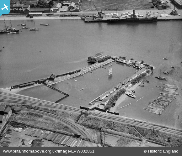
EPW032851 ENGLAND (1930). The Bathing Place, Ipswich, 1930
© Copyright OpenStreetMap contributors and licensed by the OpenStreetMap Foundation. 2026. Cartography is licensed as CC BY-SA.
Nearby Images (23)
EPW032851

EPW032860

EPW032857

EAW025115

EPW041401

EAW025112

EAW026269

EAW026268

EAW026273

EAW026272

EAW025111

EAW026270

EAW026267

EAW025109

EPW032841

EAW026266

EPW024976

EAW026265

EPW024986

EAW024669

EAW025110

EAW025114

EPW001825

Details
| Title | [EPW032851] The Bathing Place, Ipswich, 1930 |
| Reference | EPW032851 |
| Date | June-1930 |
| Link | |
| Place name | IPSWICH |
| Parish | |
| District | |
| Country | ENGLAND |
| Easting / Northing | 616731, 243080 |
| Longitude / Latitude | 1.1607577343694, 52.043255635342 |
| National Grid Reference | TM167431 |
Pins
Be the first to add a comment to this image!