
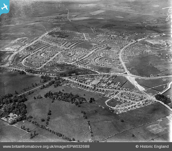
EPW032688 ENGLAND (1930). New housing estates at Lupset, Wakefield, from the south-east, 1930
© Copyright OpenStreetMap contributors and licensed by the OpenStreetMap Foundation. 2026. Cartography is licensed as CC BY-SA.
Nearby Images (3)
EPW032688

EPW032690

EAW025167

Details
| Title | [EPW032688] New housing estates at Lupset, Wakefield, from the south-east, 1930 |
| Reference | EPW032688 |
| Date | June-1930 |
| Link | |
| Place name | WAKEFIELD |
| Parish | |
| District | |
| Country | ENGLAND |
| Easting / Northing | 431849, 419286 |
| Longitude / Latitude | -1.5178927767472, 53.668849948926 |
| National Grid Reference | SE318193 |
Pins
Be the first to add a comment to this image!