
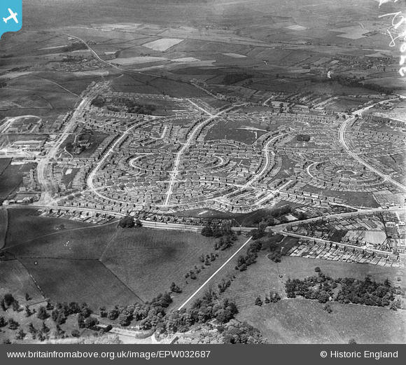
EPW032687 ENGLAND (1930). New housing estates at Lupset, Wakefield, from the south-east, 1930
© Copyright OpenStreetMap contributors and licensed by the OpenStreetMap Foundation. 2026. Cartography is licensed as CC BY-SA.
Nearby Images (5)
EPW032687

EPW032686

EPW032689

EAW025168

EAW025167

Details
| Title | [EPW032687] New housing estates at Lupset, Wakefield, from the south-east, 1930 |
| Reference | EPW032687 |
| Date | June-1930 |
| Link | |
| Place name | WAKEFIELD |
| Parish | |
| District | |
| Country | ENGLAND |
| Easting / Northing | 431394, 419319 |
| Longitude / Latitude | -1.5247766388299, 53.669174109519 |
| National Grid Reference | SE314193 |
Pins

trevorsboy |
Tuesday 15th of March 2016 07:43:23 PM | |
|
trevorsboy |
Tuesday 15th of March 2016 07:40:36 PM | |
|
trevorsboy |
Tuesday 15th of March 2016 07:38:31 PM | |
|
trevorsboy |
Tuesday 15th of March 2016 07:35:52 PM | |
|
trevorsboy |
Tuesday 15th of March 2016 07:32:36 PM | |
|
trevorsboy |
Tuesday 15th of March 2016 07:30:54 PM | |
|
trevorsboy |
Tuesday 15th of March 2016 07:29:04 PM | |
|
trevorsboy |
Tuesday 15th of March 2016 07:21:46 PM | |
|
trevorsboy |
Tuesday 15th of March 2016 07:21:45 PM |