
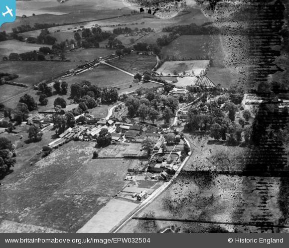
EPW032504 ENGLAND (1930). The village, Compton, 1930. This image has been produced from a damaged negative.
© Copyright OpenStreetMap contributors and licensed by the OpenStreetMap Foundation. 2026. Cartography is licensed as CC BY-SA.
Nearby Images (4)
EPW032504

EPW032507

EPW032506

EPW032505

Details
| Title | [EPW032504] The village, Compton, 1930. This image has been produced from a damaged negative. |
| Reference | EPW032504 |
| Date | June-1930 |
| Link | |
| Place name | COMPTON |
| Parish | COMPTON |
| District | |
| Country | ENGLAND |
| Easting / Northing | 452106, 180128 |
| Longitude / Latitude | -1.2489714928309, 51.517186054467 |
| National Grid Reference | SU521801 |
Pins

apc66 |
Monday 17th of February 2014 10:58:16 PM | |
|
apc66 |
Monday 17th of February 2014 10:42:58 PM | |
|
apc66 |
Monday 17th of February 2014 10:41:50 PM | |
|
apc66 |
Monday 17th of February 2014 10:40:38 PM | |
|
apc66 |
Monday 17th of February 2014 10:38:21 PM | |
|
apc66 |
Monday 17th of February 2014 10:37:11 PM | |
|
apc66 |
Monday 17th of February 2014 10:34:13 PM | |
|
apc66 |
Monday 17th of February 2014 10:33:14 PM | |
|
apc66 |
Monday 17th of February 2014 10:30:16 PM | |
|
apc66 |
Monday 17th of February 2014 10:09:02 PM | |
|
apc66 |
Monday 17th of February 2014 10:08:00 PM |
User Comment Contributions
Where have my annotations gone! In the process of moving this image from Wales we seem to have lost the history. See also EPW032506 where all the history has gone. I would like viewers to know that I was successful in locating these images. I was under the impression that everything we put on the site is there for ever. This is obviously an erroneous view. Please tell me that that this loss of data is just a blip and that the policy is to retain everything. |

Class31 |
Tuesday 17th of December 2013 07:39:09 AM |