
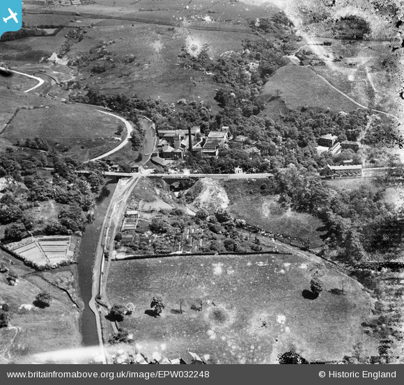
EPW032248 ENGLAND (1930). The Bardsley Vale Mills and Bardsley Bridge, Limehurst, 1930. This image has been produced from a damaged negative.
© Copyright OpenStreetMap contributors and licensed by the OpenStreetMap Foundation. 2026. Cartography is licensed as CC BY-SA.
Nearby Images (10)
EPW032248

EPW032251

EPW032254

EPW032247

EPW032258

EPW032253

EPW032257

EPW032256

EPW032249

EPW032255

Details
| Title | [EPW032248] The Bardsley Vale Mills and Bardsley Bridge, Limehurst, 1930. This image has been produced from a damaged negative. |
| Reference | EPW032248 |
| Date | June-1930 |
| Link | |
| Place name | LIMEHURST |
| Parish | |
| District | |
| Country | ENGLAND |
| Easting / Northing | 393011, 401293 |
| Longitude / Latitude | -2.1053932041597, 53.50802888815 |
| National Grid Reference | SD930013 |
Pins

Barney Rubble |
Tuesday 23rd of July 2019 02:22:54 PM | |
|
John T. Pitman |
Wednesday 15th of October 2014 11:49:20 PM |