
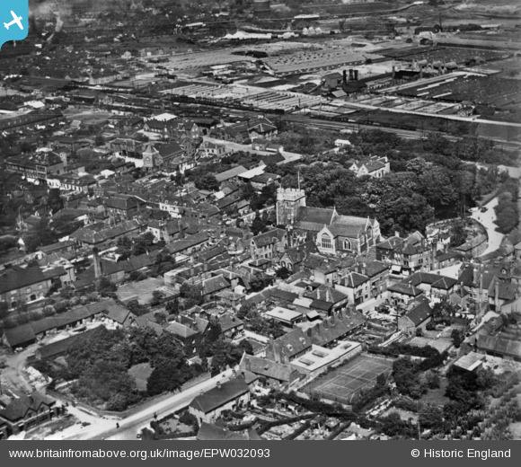
EPW032093 ENGLAND (1930). St Michael's Church and the town, Sittingbourne, 1930. This image has been produced from a print.
© Copyright OpenStreetMap contributors and licensed by the OpenStreetMap Foundation. 2026. Cartography is licensed as CC BY-SA.
Nearby Images (2)
EPW032093

EPW032095

Details
| Title | [EPW032093] St Michael's Church and the town, Sittingbourne, 1930. This image has been produced from a print. |
| Reference | EPW032093 |
| Date | May-1930 |
| Link | |
| Place name | SITTINGBOURNE |
| Parish | |
| District | |
| Country | ENGLAND |
| Easting / Northing | 590897, 163629 |
| Longitude / Latitude | 0.74102773392131, 51.339145930831 |
| National Grid Reference | TQ909636 |
Pins

Bryn |
Sunday 14th of August 2016 04:26:48 PM | |
|
Bryn |
Sunday 14th of August 2016 04:23:33 PM | |
|
Bryn |
Sunday 21st of February 2016 03:01:09 PM | |
|
Bryn |
Sunday 21st of February 2016 02:59:59 PM | |
|
Bryn |
Sunday 21st of February 2016 02:54:54 PM | |
|
stmichaelschoir |
Saturday 15th of August 2015 07:44:21 PM | |
|
Bryn |
Saturday 17th of January 2015 04:59:03 PM | |
The church's name is: St Michael The Archangel |
stmichaelschoir |
Saturday 15th of August 2015 07:43:20 PM |
|
Bryn |
Saturday 17th of January 2015 04:58:01 PM | |
|
Bryn |
Saturday 17th of January 2015 04:57:15 PM | |
|
Bryn |
Saturday 17th of January 2015 04:55:56 PM | |
|
Bryn |
Saturday 17th of January 2015 04:50:19 PM |