
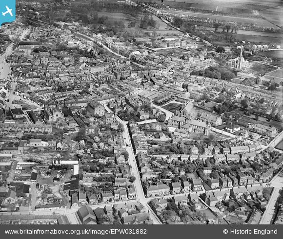
EPW031882 ENGLAND (1930). The town centre, Spalding, 1930
© Copyright OpenStreetMap contributors and licensed by the OpenStreetMap Foundation. 2026. Cartography is licensed as CC BY-SA.
Nearby Images (7)
EPW031882

EPW031855

EPW031854

EPW031870

EPW031856

EPW031852

EAW004499

Details
| Title | [EPW031882] The town centre, Spalding, 1930 |
| Reference | EPW031882 |
| Date | May-1930 |
| Link | |
| Place name | SPALDING |
| Parish | |
| District | |
| Country | ENGLAND |
| Easting / Northing | 524635, 322508 |
| Longitude / Latitude | -0.15172153959544, 52.785403999931 |
| National Grid Reference | TF246225 |
