
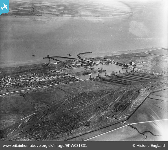
EPW031801 ENGLAND (1930). Immingham Docks and railway sidings, Immingham, 1930
© Copyright OpenStreetMap contributors and licensed by the OpenStreetMap Foundation. 2026. Cartography is licensed as CC BY-SA.
Nearby Images (9)
EPW031801

EAW030245

EAW030246

EPW031800

EAW029086

EAW030248

EAW030241

EAW029090

EAW030249

Details
| Title | [EPW031801] Immingham Docks and railway sidings, Immingham, 1930 |
| Reference | EPW031801 |
| Date | 30-April-1930 |
| Link | |
| Place name | IMMINGHAM |
| Parish | IMMINGHAM |
| District | |
| Country | ENGLAND |
| Easting / Northing | 519449, 416271 |
| Longitude / Latitude | -0.19348510733084, 53.629085854604 |
| National Grid Reference | TA194163 |
Pins

DaveH |
Monday 5th of October 2020 02:16:09 PM |