
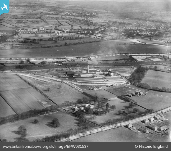
EPW031537 ENGLAND (1930). The Poppleton Sugar Beet Factory, Clifton Ings and surroundings, York, 1930
© Copyright OpenStreetMap contributors and licensed by the OpenStreetMap Foundation. 2026. Cartography is licensed as CC BY-SA.
Nearby Images (12)
EPW031537

EPW031535

EPW031536

EPW031538

EPW031531

EPW031533

EPW031530A

EPW031534

EPW023549

EPW023548

EPW023550

EPW031532

Details
| Title | [EPW031537] The Poppleton Sugar Beet Factory, Clifton Ings and surroundings, York, 1930 |
| Reference | EPW031537 |
| Date | February-1930 |
| Link | |
| Place name | YORK |
| Parish | |
| District | |
| Country | ENGLAND |
| Easting / Northing | 457640, 453006 |
| Longitude / Latitude | -1.1212073922479, 53.969715269571 |
| National Grid Reference | SE576530 |
Pins
Be the first to add a comment to this image!
User Comment Contributions
In the top left hand corner of this picture is the first houses built in clifton without, the first line are on Shipton Road (still called Skelton Road at the time) and behind are those on odd numbered side of Rawcliffe Lane. A few gaps in the housing line on Rawcliife Lane although these dissappered within a year. The first few houses have been built on the even numbered side of Rawcliffe Lane have been built, but most houses on this side do not appear for a few more years. |

markyork |
Sunday 8th of July 2012 06:52:35 PM |