
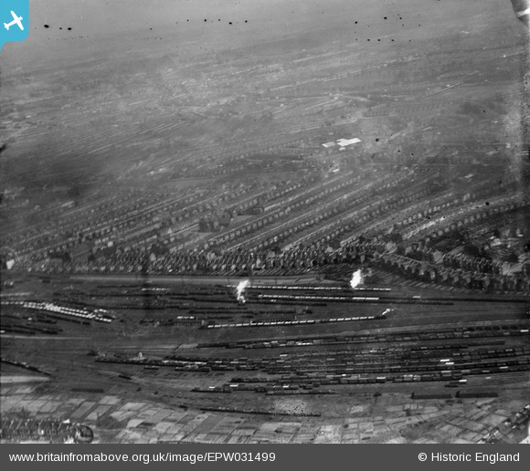
EPW031499 ENGLAND (1930). Ferme Park Sidings, terraced housing along Wightman Road and environs, Harringay, from the south-west, 1930
© Copyright OpenStreetMap contributors and licensed by the OpenStreetMap Foundation. 2026. Cartography is licensed as CC BY-SA.
Nearby Images (2)
EPW031499

EAW034516

Details
| Title | [EPW031499] Ferme Park Sidings, terraced housing along Wightman Road and environs, Harringay, from the south-west, 1930 |
| Reference | EPW031499 |
| Date | February-1930 |
| Link | |
| Place name | HARRINGAY |
| Parish | |
| District | |
| Country | ENGLAND |
| Easting / Northing | 531146, 188778 |
| Longitude / Latitude | -0.10697206808417, 51.582107830315 |
| National Grid Reference | TQ311888 |
Pins

Class31 |
Wednesday 13th of February 2013 02:50:23 PM | |
|
Class31 |
Wednesday 13th of February 2013 02:49:06 PM | |
|
Class31 |
Wednesday 13th of February 2013 02:48:36 PM | |
|
Class31 |
Wednesday 13th of February 2013 02:48:03 PM | |
|
Class31 |
Wednesday 13th of February 2013 02:47:40 PM | |
|
Class31 |
Wednesday 13th of February 2013 02:47:09 PM | |

AlexSmee |
Sunday 16th of December 2012 05:30:31 PM | |
|
Richard Woods |
Wednesday 18th of July 2012 04:30:45 PM |