
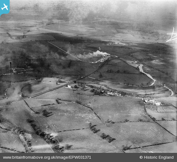
EPW031371 ENGLAND (1930). The deserted village of Hampton Gay, St Giles's Church and the Alpha Cement Works, Hampton Gay, from the south-east, 1930
© Copyright OpenStreetMap contributors and licensed by the OpenStreetMap Foundation. 2025. Cartography is licensed as CC BY-SA.
Nearby Images (2)
EPW031371

EPW031374

Details
| Title | [EPW031371] The deserted village of Hampton Gay, St Giles's Church and the Alpha Cement Works, Hampton Gay, from the south-east, 1930 |
| Reference | EPW031371 |
| Date | February-1930 |
| Link | |
| Place name | HAMPTON GAY |
| Parish | HAMPTON GAY AND POYLE |
| District | |
| Country | ENGLAND |
| Easting / Northing | 448709, 216211 |
| Longitude / Latitude | -1.2928944354216, 51.841931393616 |
| National Grid Reference | SP487162 |
Pins

Dylan Moore |
Monday 17th of November 2014 10:16:21 AM | |

Nowy Paul |
Saturday 15th of November 2014 12:55:06 PM | |
|
Dylan Moore |
Monday 22nd of October 2012 06:42:42 PM | |
|
totoro |
Thursday 26th of July 2012 09:16:15 AM |