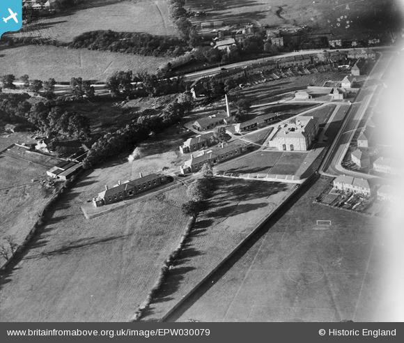
EPW030079 ENGLAND (1929). Hendon Isolation Hospital, West Hendon, 1929
© Copyright OpenStreetMap contributors and licensed by the OpenStreetMap Foundation. 2026. Cartography is licensed as CC BY-SA.
Nearby Images (12)
Details
| Title | [EPW030079] Hendon Isolation Hospital, West Hendon, 1929 |
| Reference | EPW030079 |
| Date | October-1929 |
| Link | |
| Place name | WEST HENDON |
| Parish | |
| District | |
| Country | ENGLAND |
| Easting / Northing | 521257, 188411 |
| Longitude / Latitude | -0.24976705561928, 51.581024059322 |
| National Grid Reference | TQ213884 |


![[EPW030079] Hendon Isolation Hospital, West Hendon, 1929](http://britainfromabove.org.uk/sites/all/libraries/aerofilms-images/public/100x100/EPW/030/EPW030079.jpg)
![[EPW029984] Hendon Corporation Isolation Hospital, West Hendon, 1929](http://britainfromabove.org.uk/sites/all/libraries/aerofilms-images/public/100x100/EPW/029/EPW029984.jpg)
![[EPW029985] Hendon Corporation Isolation Hospital, West Hendon, 1929](http://britainfromabove.org.uk/sites/all/libraries/aerofilms-images/public/100x100/EPW/029/EPW029985.jpg)
![[EPW029988] Hendon Corporation Isolation Hospital, West Hendon, 1929](http://britainfromabove.org.uk/sites/all/libraries/aerofilms-images/public/100x100/EPW/029/EPW029988.jpg)
![[EPW030078] Hendon Isolation Hospital, West Hendon, 1929](http://britainfromabove.org.uk/sites/all/libraries/aerofilms-images/public/100x100/EPW/030/EPW030078.jpg)
![[EPW029986] Hendon Corporation Isolation Hospital, West Hendon, 1929](http://britainfromabove.org.uk/sites/all/libraries/aerofilms-images/public/100x100/EPW/029/EPW029986.jpg)
![[EPW029987] Hendon Corporation Isolation Hospital, West Hendon, 1929](http://britainfromabove.org.uk/sites/all/libraries/aerofilms-images/public/100x100/EPW/029/EPW029987.jpg)
![[EPW034475] Housing under construction at Ennerdale Drive, Colindale and Hendon Aerodrome, Kingsbury, from the south, 1930](http://britainfromabove.org.uk/sites/all/libraries/aerofilms-images/public/100x100/EPW/034/EPW034475.jpg)
![[EPW034478] Housing under construction at Springfield Mount and environs, Kingsbury, from the south, 1930](http://britainfromabove.org.uk/sites/all/libraries/aerofilms-images/public/100x100/EPW/034/EPW034478.jpg)
![[EAW020700] The Edgware Road running through Edgware and Stanmore, Hendon, from the south-east, 1948](http://britainfromabove.org.uk/sites/all/libraries/aerofilms-images/public/100x100/EAW/020/EAW020700.jpg)
![[EPW021259] New housing under construction at Goldsmith Avenue, The Hyde, 1928](http://britainfromabove.org.uk/sites/all/libraries/aerofilms-images/public/100x100/EPW/021/EPW021259.jpg)
![[EAW020701] The Edgware Road running through Edgware and Stanmore, Hendon, from the south-east, 1948](http://britainfromabove.org.uk/sites/all/libraries/aerofilms-images/public/100x100/EAW/020/EAW020701.jpg)
