
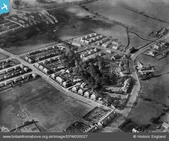
EPW030027 ENGLAND (1929). New housing estate at Palace House, Burnley, 1929
© Copyright OpenStreetMap contributors and licensed by the OpenStreetMap Foundation. 2026. Cartography is licensed as CC BY-SA.
Nearby Images (3)
EPW030027

EPW030024

EPW030023

Details
| Title | [EPW030027] New housing estate at Palace House, Burnley, 1929 |
| Reference | EPW030027 |
| Date | October-1929 |
| Link | |
| Place name | BURNLEY |
| Parish | |
| District | |
| Country | ENGLAND |
| Easting / Northing | 381726, 433242 |
| Longitude / Latitude | -2.2774470567423, 53.794951432384 |
| National Grid Reference | SD817332 |
