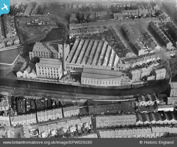
EPW029180 ENGLAND (1929). Bath Cotton Mill, Lancaster, 1929
    © Copyright OpenStreetMap contributors and licensed by the OpenStreetMap Foundation. 2025. Cartography is licensed as CC BY-SA.
  
Nearby Images (5)
Details
| Title | [EPW029180] Bath Cotton Mill, Lancaster, 1929 | 
| Reference | EPW029180 | 
| Date | October-1929 | 
| Link | |
| Place name | LANCASTER | 
| Parish | |
| District | |
| Country | ENGLAND | 
| Easting / Northing | 348124, 461803 | 
| Longitude / Latitude | -2.792423925897, 54.049391772475 | 
| National Grid Reference | SD481618 | 
Pins
Be the first to add a comment to this image!
 
             
  ![[EPW029180] Bath Cotton Mill, Lancaster, 1929](http://britainfromabove.org.uk/sites/all/libraries/aerofilms-images/public/100x100/EPW/029/EPW029180.jpg) 
  
                                          ![[EPW042036] The Lancaster Canal and the city, Lancaster, 1933](http://britainfromabove.org.uk/sites/all/libraries/aerofilms-images/public/100x100/EPW/042/EPW042036.jpg) 
 ![[EAW037608] The Royal Grammar School and Freehold, Lancaster, 1951. This image has been produced from a print marked by Aerofilms Ltd for photo editing.](http://britainfromabove.org.uk/sites/all/libraries/aerofilms-images/public/100x100/EAW/037/EAW037608.jpg) 
 ![[EAW037610] The Royal Grammar School and the surrounding residential area, Lancaster, 1951. This image has been produced from a print marked by Aerofilms Ltd for photo editing.](http://britainfromabove.org.uk/sites/all/libraries/aerofilms-images/public/100x100/EAW/037/EAW037610.jpg) 
 ![[EAW037609] The Royal Grammar School, Lancaster, 1951. This image has been produced from a print marked by Aerofilms Ltd for photo editing.](http://britainfromabove.org.uk/sites/all/libraries/aerofilms-images/public/100x100/EAW/037/EAW037609.jpg)