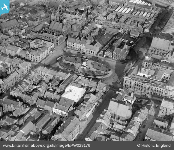
EPW029176 ENGLAND (1929). Dalton Square, Lancaster, 1929
    © Copyright OpenStreetMap contributors and licensed by the OpenStreetMap Foundation. 2025. Cartography is licensed as CC BY-SA.
  
Nearby Images (7)
Details
| Title | [EPW029176] Dalton Square, Lancaster, 1929 | 
| Reference | EPW029176 | 
| Date | October-1929 | 
| Link | |
| Place name | LANCASTER | 
| Parish | |
| District | |
| Country | ENGLAND | 
| Easting / Northing | 347860, 461610 | 
| Longitude / Latitude | -2.7964230162545, 54.047630498312 | 
| National Grid Reference | SD479616 | 
 
             
  ![[EPW029176] Dalton Square, Lancaster, 1929](http://britainfromabove.org.uk/sites/all/libraries/aerofilms-images/public/100x100/EPW/029/EPW029176.jpg) 
  
                                          ![[EPW029183] Dalton Square and environs, Lancaster, 1929](http://britainfromabove.org.uk/sites/all/libraries/aerofilms-images/public/100x100/EPW/029/EPW029183.jpg) 
 ![[EPW002087] Dalton Square and the city centre, Lancaster, 1920](http://britainfromabove.org.uk/sites/all/libraries/aerofilms-images/public/100x100/EPW/002/EPW002087.jpg) 
 ![[EPW042038] The Town Hall, Great John Street and the city centre, Lancaster, 1933](http://britainfromabove.org.uk/sites/all/libraries/aerofilms-images/public/100x100/EPW/042/EPW042038.jpg) 
 ![[EPW002081] The city centre, Lancaster, 1920](http://britainfromabove.org.uk/sites/all/libraries/aerofilms-images/public/100x100/EPW/002/EPW002081.jpg) 
 ![[EPW042036] The Lancaster Canal and the city, Lancaster, 1933](http://britainfromabove.org.uk/sites/all/libraries/aerofilms-images/public/100x100/EPW/042/EPW042036.jpg) 
 ![[EPW002088] St Peter's Roman Catholic Cathedral, Lancaster, 1920](http://britainfromabove.org.uk/sites/all/libraries/aerofilms-images/public/100x100/EPW/002/EPW002088.jpg) 
  Brock Street Methodist Church now The Sultan of Lancaster Restaurant, Lancaster, 16/07/2015
 Brock Street Methodist Church now The Sultan of Lancaster Restaurant, Lancaster, 16/07/2015