
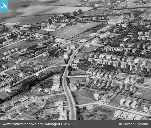
EPW028358 ENGLAND (1929). Stanwell Road and environs, Ashford, 1929
© Copyright OpenStreetMap contributors and licensed by the OpenStreetMap Foundation. 2026. Cartography is licensed as CC BY-SA.
Nearby Images (2)
EPW028358

EPW028363

Details
| Title | [EPW028358] Stanwell Road and environs, Ashford, 1929 |
| Reference | EPW028358 |
| Date | 10-August-1929 |
| Link | |
| Place name | ASHFORD |
| Parish | |
| District | |
| Country | ENGLAND |
| Easting / Northing | 506296, 171402 |
| Longitude / Latitude | -0.47075437840313, 51.431146404784 |
| National Grid Reference | TQ063714 |
Pins

JOHNAA |
Wednesday 20th of November 2013 01:09:35 AM | |
|
JOHNAA |
Wednesday 20th of November 2013 01:08:44 AM | |
|
Neil Smith |
Wednesday 11th of September 2013 04:49:42 PM | |
|
Neil Smith |
Wednesday 11th of September 2013 04:49:25 PM |