
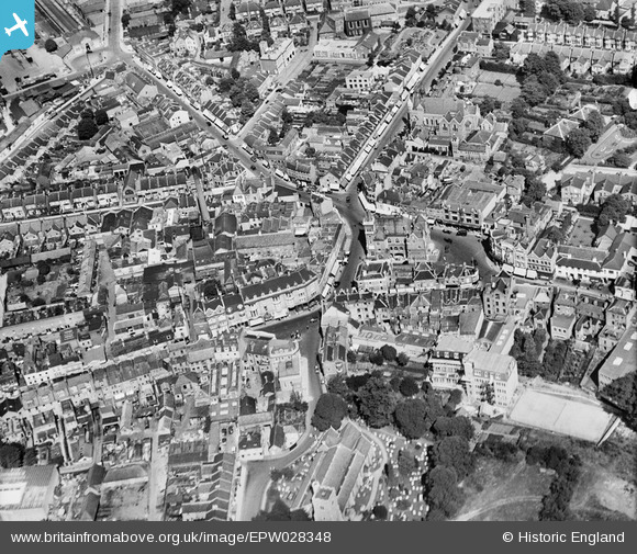
EPW028348 ENGLAND (1929). The town centre, Bromley, 1929
© Copyright OpenStreetMap contributors and licensed by the OpenStreetMap Foundation. 2026. Cartography is licensed as CC BY-SA.
Nearby Images (3)
EPW028348

EPW028350

EPW028344

Details
| Title | [EPW028348] The town centre, Bromley, 1929 |
| Reference | EPW028348 |
| Date | August-1929 |
| Link | |
| Place name | BROMLEY |
| Parish | |
| District | |
| Country | ENGLAND |
| Easting / Northing | 540228, 169345 |
| Longitude / Latitude | 0.016314584325027, 51.40527812375 |
| National Grid Reference | TQ402693 |
Pins

Ken |
Friday 6th of June 2014 11:17:23 PM | |
|
Ken |
Friday 6th of June 2014 11:12:54 PM | |
|
ronS |
Saturday 24th of August 2013 12:11:33 AM | |
|
ronS |
Saturday 24th of August 2013 12:10:53 AM | |

Class31 |
Saturday 3rd of November 2012 04:11:21 PM | |
|
Class31 |
Saturday 3rd of November 2012 04:11:06 PM | |
|
Class31 |
Saturday 3rd of November 2012 04:10:43 PM | |
|
Class31 |
Saturday 3rd of November 2012 04:10:21 PM | |
|
Class31 |
Saturday 3rd of November 2012 04:09:58 PM | |
|
Class31 |
Saturday 3rd of November 2012 04:09:11 PM |