
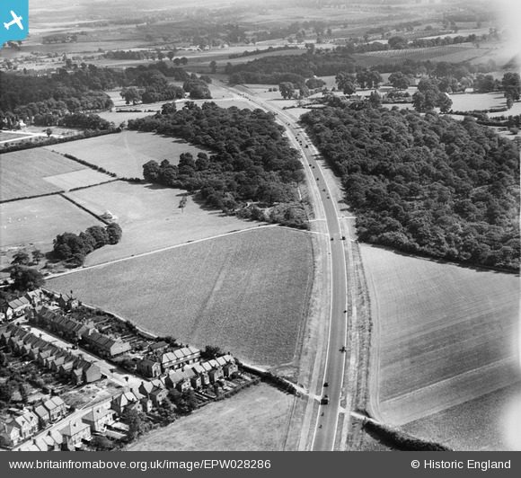
EPW028286 ENGLAND (1929). Beaver's Wood and Sidcup Road, Sidcup, 1929
© Copyright OpenStreetMap contributors and licensed by the OpenStreetMap Foundation. 2026. Cartography is licensed as CC BY-SA.
Nearby Images (2)
EPW028286

EPW045620
 cutting through Beaver's Wood and Scadbury Park, Chislehurst, 1934. This image has been produced from a damaged negative.")
Details
| Title | [EPW028286] Beaver's Wood and Sidcup Road, Sidcup, 1929 |
| Reference | EPW028286 |
| Date | August-1929 |
| Link | |
| Place name | SIDCUP |
| Parish | |
| District | |
| Country | ENGLAND |
| Easting / Northing | 545405, 171555 |
| Longitude / Latitude | 0.091607989388995, 51.423834794565 |
| National Grid Reference | TQ454716 |
Pins

Stephen Challis |
Monday 16th of February 2015 12:46:03 PM | |
|
Stephen Challis |
Monday 16th of February 2015 12:43:21 PM | |
|
Stephen Challis |
Monday 16th of February 2015 12:40:13 PM | |
|
Stephen Challis |
Monday 16th of February 2015 12:39:48 PM | |
|
Stephen Challis |
Monday 16th of February 2015 12:38:13 PM | |
|
Stephen Challis |
Monday 16th of February 2015 12:37:42 PM | |
|
Stephen Challis |
Monday 16th of February 2015 12:36:15 PM | |
|
Stephen Challis |
Monday 16th of February 2015 12:33:50 PM | |
|
Stephen Challis |
Monday 16th of February 2015 12:33:28 PM | |
|
Stephen Challis |
Monday 16th of February 2015 12:32:47 PM | |
|
Stephen Challis |
Monday 16th of February 2015 12:25:48 PM | |
|
Stephen Challis |
Monday 16th of February 2015 12:24:54 PM | |
|
Stephen Challis |
Monday 16th of February 2015 12:23:38 PM | |
|
Stephen Challis |
Monday 16th of February 2015 12:22:44 PM | |
|
Stephen Challis |
Monday 16th of February 2015 12:19:49 PM | |
|
Stephen Challis |
Monday 16th of February 2015 12:18:46 PM | |
|
Stephen Challis |
Monday 16th of February 2015 12:18:41 PM |