
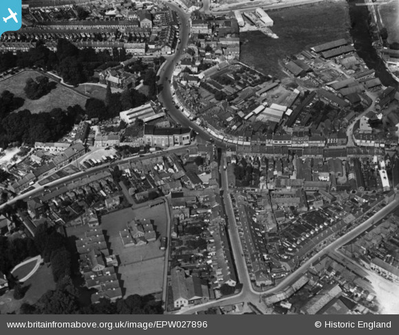
EPW027896 ENGLAND (1929). The junction of Staplegrove Road and Station Road, Taunton, 1929. This image has been produced from a print.
© Copyright OpenStreetMap contributors and licensed by the OpenStreetMap Foundation. 2026. Cartography is licensed as CC BY-SA.
Nearby Images (6)
EPW027896

EPW027888

EPW027897

EPW013543

EPW027895

EPW041185

Details
| Title | [EPW027896] The junction of Staplegrove Road and Station Road, Taunton, 1929. This image has been produced from a print. |
| Reference | EPW027896 |
| Date | 28-June-1929 |
| Link | |
| Place name | TAUNTON |
| Parish | |
| District | |
| Country | ENGLAND |
| Easting / Northing | 322500, 125000 |
| Longitude / Latitude | -3.1050290788454, 51.018606813954 |
| National Grid Reference | ST225250 |
Pins

gBr |
Friday 28th of April 2017 01:18:16 PM |