
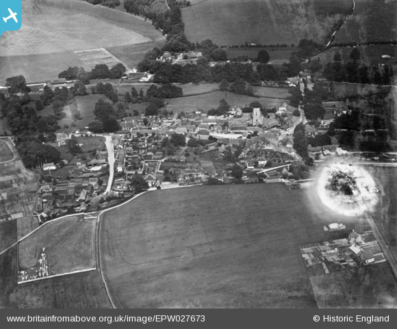
EPW027673 ENGLAND (1929). The village, Upavon, 1929. This image has been produced from a damaged copy-negative.
© Copyright OpenStreetMap contributors and licensed by the OpenStreetMap Foundation. 2026. Cartography is licensed as CC BY-SA.
Nearby Images (5)
EPW027673

EPW027675

EPW027671

EPW027674

EPW027672

Details
| Title | [EPW027673] The village, Upavon, 1929. This image has been produced from a damaged copy-negative. |
| Reference | EPW027673 |
| Date | 21-June-1929 |
| Link | |
| Place name | UPAVON |
| Parish | UPAVON |
| District | |
| Country | ENGLAND |
| Easting / Northing | 413430, 155086 |
| Longitude / Latitude | -1.8073671999813, 51.294237652935 |
| National Grid Reference | SU134551 |
Pins
Be the first to add a comment to this image!