
EPW027652 ENGLAND (1929). All Saints' Church and the town centre, Westbury, 1929

© Copyright OpenStreetMap contributors and licensed by the OpenStreetMap Foundation. 2026. Cartography is licensed as CC BY-SA.
Nearby Images (3)
EPW027652

EPW027643

EPW011098

Details
| Title | [EPW027652] All Saints' Church and the town centre, Westbury, 1929 |
| Reference | EPW027652 |
| Date | 21-June-1929 |
| Link | |
| Place name | WESTBURY |
| Parish | WESTBURY |
| District | |
| Country | ENGLAND |
| Easting / Northing | 387309, 151436 |
| Longitude / Latitude | -2.181903357583, 51.261430877177 |
| National Grid Reference | ST873514 |
Pins

TerryL |
Monday 20th of October 2025 09:20:02 AM | |
|
SteveD |
Thursday 24th of July 2014 07:42:59 PM | |

Class31 |
Saturday 20th of October 2012 09:14:18 PM | |
|
Class31 |
Saturday 20th of October 2012 09:13:19 PM | |
|
Class31 |
Saturday 20th of October 2012 09:12:54 PM | |
|
Class31 |
Saturday 20th of October 2012 09:12:04 PM | |
|
Class31 |
Saturday 20th of October 2012 09:11:09 PM | |
|
Class31 |
Saturday 20th of October 2012 09:10:48 PM | |
|
Class31 |
Saturday 20th of October 2012 09:10:19 PM | |
|
Class31 |
Saturday 20th of October 2012 09:09:56 PM | |
|
Class31 |
Saturday 20th of October 2012 09:09:32 PM | |
|
Class31 |
Saturday 20th of October 2012 09:09:14 PM |
User Comment Contributions
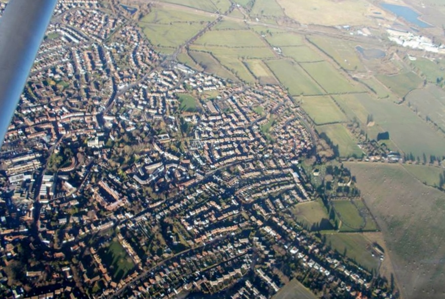
A present day aerial view of Westbury which covers some of the same area 11/01/2014. Courtesy Con Shields |
Class31 |
Tuesday 14th of January 2014 06:14:47 PM |