
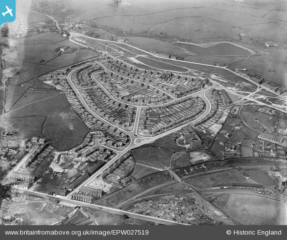
EPW027519 ENGLAND (1929). Norton Road and environs, Rochdale, 1929
© Copyright OpenStreetMap contributors and licensed by the OpenStreetMap Foundation. 2026. Cartography is licensed as CC BY-SA.
Nearby Images (3)
EPW027519

EPW027516

EPW027514

Details
| Title | [EPW027519] Norton Road and environs, Rochdale, 1929 |
| Reference | EPW027519 |
| Date | 11-June-1929 |
| Link | |
| Place name | ROCHDALE |
| Parish | |
| District | |
| Country | ENGLAND |
| Easting / Northing | 389717, 415203 |
| Longitude / Latitude | -2.1555242376354, 53.633016253187 |
| National Grid Reference | SD897152 |
Pins

Pete |
Thursday 19th of March 2026 08:50:25 AM | |

Maurice |
Thursday 7th of February 2013 04:58:30 PM | |

Class31 |
Wednesday 6th of February 2013 05:20:38 PM | |
|
Class31 |
Wednesday 6th of February 2013 05:18:30 PM | |
|
Class31 |
Wednesday 6th of February 2013 05:17:42 PM | |
|
Class31 |
Wednesday 6th of February 2013 05:14:24 PM |