
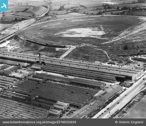
EPW026899 ENGLAND (1929). Longbridge Motor Works and Northfield Airfield, Longbridge, 1929
© Copyright OpenStreetMap contributors and licensed by the OpenStreetMap Foundation. 2026. Cartography is licensed as CC BY-SA.
Nearby Images (20)
EPW026899

EPW026895

EPW047800

EPW047794

EPW024828

EPW026900

EPW024827

EPW024825

EPW024829

EPW024826

EPW024830

EPW026897

EPW005368

EPW026901

EPW010506

EPW047805

EPW047797

EPW010505

EPW010507

EPW047801

Details
| Title | [EPW026899] Longbridge Motor Works and Northfield Airfield, Longbridge, 1929 |
| Reference | EPW026899 |
| Date | May-1929 |
| Link | |
| Place name | LONGBRIDGE |
| Parish | |
| District | |
| Country | ENGLAND |
| Easting / Northing | 400830, 277127 |
| Longitude / Latitude | -1.9878018442702, 52.391785848689 |
| National Grid Reference | SP008771 |
Pins

PURCELL |
Sunday 17th of November 2013 10:24:14 AM | |
|
PURCELL |
Sunday 17th of November 2013 10:23:24 AM | |

Maurice |
Friday 21st of December 2012 07:18:36 AM | |
|
Maurice |
Friday 21st of December 2012 07:17:48 AM | |
|
Maurice |
Friday 21st of December 2012 07:16:47 AM | |
|
Maurice |
Friday 21st of December 2012 07:16:12 AM |