
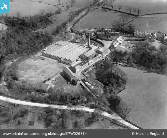
EPW026814 ENGLAND (1929). Meal Bank Industrial Colony, Meal Bank, 1929
© Copyright OpenStreetMap contributors and licensed by the OpenStreetMap Foundation. 2025. Cartography is licensed as CC BY-SA.
Nearby Images (4)
EPW026814

EPW026815

EPW026813

EPW026812

Details
| Title | [EPW026814] Meal Bank Industrial Colony, Meal Bank, 1929 |
| Reference | EPW026814 |
| Date | May-1929 |
| Link | |
| Place name | MEAL BANK |
| Parish | SCALTHWAITERIGG |
| District | |
| Country | ENGLAND |
| Easting / Northing | 354003, 495683 |
| Longitude / Latitude | -2.7078135560817, 54.354454027377 |
| National Grid Reference | SD540957 |
Pins
Be the first to add a comment to this image!