
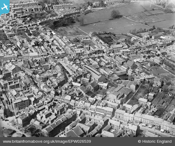
EPW026539 ENGLAND (1929). The Market Hall, Market Place and environs, Kendal, 1929
© Copyright OpenStreetMap contributors and licensed by the OpenStreetMap Foundation. 2026. Cartography is licensed as CC BY-SA.
Nearby Images (6)
EPW026539

EAW043383

EPW026543

EPW038827

EPW026547

EAW043384

Details
| Title | [EPW026539] The Market Hall, Market Place and environs, Kendal, 1929 |
| Reference | EPW026539 |
| Date | May-1929 |
| Link | |
| Place name | KENDAL |
| Parish | KENDAL |
| District | |
| Country | ENGLAND |
| Easting / Northing | 351571, 492831 |
| Longitude / Latitude | -2.7447708770707, 54.328596611863 |
| National Grid Reference | SD516928 |
Pins
Be the first to add a comment to this image!