
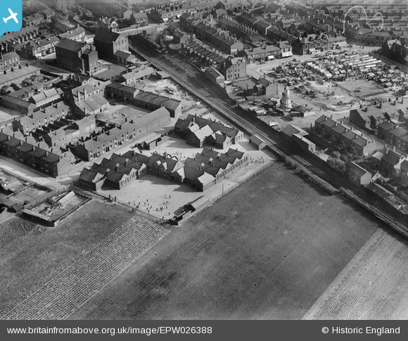
EPW026388 ENGLAND (1929). Earlestown Infant School and the Market Place, Earlestown, 1929
© Copyright OpenStreetMap contributors and licensed by the OpenStreetMap Foundation. 2026. Cartography is licensed as CC BY-SA.
Nearby Images (4)
EPW026388

EPW026387

EPW026385

EPW026384

Details
| Title | [EPW026388] Earlestown Infant School and the Market Place, Earlestown, 1929 |
| Reference | EPW026388 |
| Date | April-1929 |
| Link | |
| Place name | EARLESTOWN |
| Parish | |
| District | |
| Country | ENGLAND |
| Easting / Northing | 357503, 395463 |
| Longitude / Latitude | -2.6400385716571, 53.453952362216 |
| National Grid Reference | SJ575955 |
Pins

NeilRobertson |
Thursday 30th of September 2021 08:28:12 PM | |
|
NeilRobertson |
Thursday 30th of September 2021 08:27:27 PM | |
|
NeilRobertson |
Thursday 30th of September 2021 08:26:43 PM | |

St Helens Pubs |
Monday 26th of September 2016 01:53:08 PM | |
|
St Helens Pubs |
Monday 26th of September 2016 01:43:58 PM | |
|
Dave |
Thursday 31st of October 2013 12:40:59 PM |
