
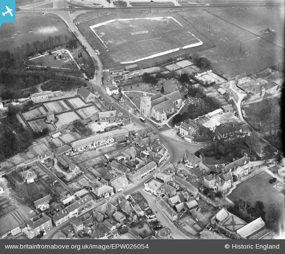
EPW026054 ENGLAND (1929). St George's Church and the village, Wrotham, 1929
© Copyright OpenStreetMap contributors and licensed by the OpenStreetMap Foundation. 2026. Cartography is licensed as CC BY-SA.
Nearby Images (6)
EPW026054

EPW032150

EPW026050

EPW032149

EPW032148

EPW026053

Details
| Title | [EPW026054] St George's Church and the village, Wrotham, 1929 |
| Reference | EPW026054 |
| Date | April-1929 |
| Link | |
| Place name | WROTHAM |
| Parish | WROTHAM |
| District | |
| Country | ENGLAND |
| Easting / Northing | 561162, 159182 |
| Longitude / Latitude | 0.3124693330807, 51.308397163822 |
| National Grid Reference | TQ612592 |
Pins
Be the first to add a comment to this image!