
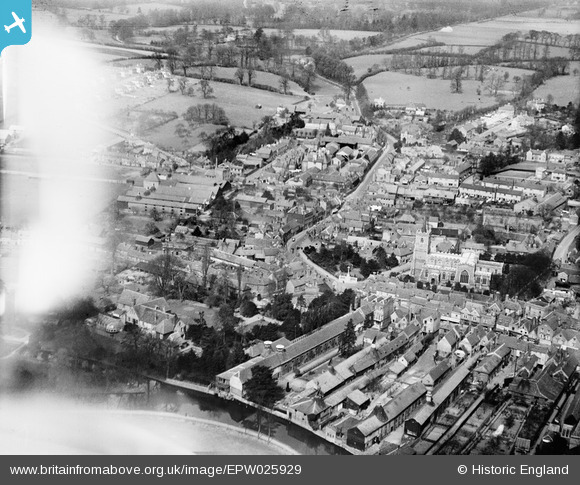
EPW025929 ENGLAND (1929). Baldock Street and environs, Ware, 1929
© Copyright OpenStreetMap contributors and licensed by the OpenStreetMap Foundation. 2026. Cartography is licensed as CC BY-SA.
Nearby Images (6)
EPW025929

EPW025931

EPW025935

EAW022367

EPW013338

EPW013342

Details
| Title | [EPW025929] Baldock Street and environs, Ware, 1929 |
| Reference | EPW025929 |
| Date | 3-April-1929 |
| Link | |
| Place name | WARE |
| Parish | WARE |
| District | |
| Country | ENGLAND |
| Easting / Northing | 535578, 214450 |
| Longitude / Latitude | -0.033057584057399, 51.811771367644 |
| National Grid Reference | TL356145 |
Pins

Grk |
Thursday 26th of December 2024 08:44:47 PM | |
|
Grk |
Thursday 26th of December 2024 08:44:11 PM | |
|
Grk |
Thursday 26th of December 2024 08:43:44 PM | |
|
Grk |
Thursday 26th of December 2024 08:42:56 PM | |
|
Grk |
Thursday 26th of December 2024 08:41:04 PM | |
|
Grk |
Thursday 26th of December 2024 08:40:34 PM | |
|
Grk |
Thursday 26th of December 2024 08:39:58 PM | |
|
Grk |
Thursday 26th of December 2024 08:39:31 PM | |
|
Catkin |
Saturday 26th of September 2020 09:10:47 AM | |
|
Platenut |
Thursday 12th of December 2019 03:53:35 PM | |

Class31 |
Monday 26th of May 2014 09:21:25 PM | |
|
NAM2505 |
Sunday 23rd of June 2013 04:27:53 AM |
