
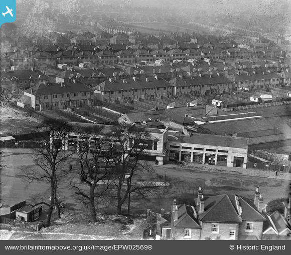
EPW025698 ENGLAND (1929). Morden Underground Station, Morden, 1929
© Copyright OpenStreetMap contributors and licensed by the OpenStreetMap Foundation. 2026. Cartography is licensed as CC BY-SA.
Nearby Images (17)
EPW025698

EPW016531

EPW025692

EPW025694

EPW031964

EPW025695

EPW025699

EPW025693

EPW031965

EPW025697

EPW016568

EPW016530

EPW016570

EPW016570
EPW016567

EPW016575

EPW016575
Details
| Title | [EPW025698] Morden Underground Station, Morden, 1929 |
| Reference | EPW025698 |
| Date | 1929 |
| Link | |
| Place name | MORDEN |
| Parish | |
| District | |
| Country | ENGLAND |
| Easting / Northing | 525661, 168581 |
| Longitude / Latitude | -0.19329412476428, 51.401826586508 |
| National Grid Reference | TQ257686 |
Pins

Class31 |
Friday 5th of October 2012 05:02:46 PM | |
|
Class31 |
Friday 5th of October 2012 05:01:53 PM | |
|
Class31 |
Friday 5th of October 2012 05:01:15 PM | |
|
Class31 |
Friday 5th of October 2012 04:59:56 PM | |
|
Class31 |
Friday 5th of October 2012 04:59:26 PM |