
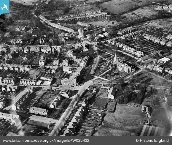
EPW025432 ENGLAND (1928). St Peter and St Paul's Church and The Green, Chingford Green, 1928
© Copyright OpenStreetMap contributors and licensed by the OpenStreetMap Foundation. 2026. Cartography is licensed as CC BY-SA.
Nearby Images (5)
EPW025432

EPW025426

EPW025366

EPW025431

EPW025368

Details
| Title | [EPW025432] St Peter and St Paul's Church and The Green, Chingford Green, 1928 |
| Reference | EPW025432 |
| Date | 8-November-1928 |
| Link | |
| Place name | CHINGFORD GREEN |
| Parish | |
| District | |
| Country | ENGLAND |
| Easting / Northing | 538546, 194331 |
| Longitude / Latitude | 0.0019695385377297, 51.630241060672 |
| National Grid Reference | TQ385943 |
