
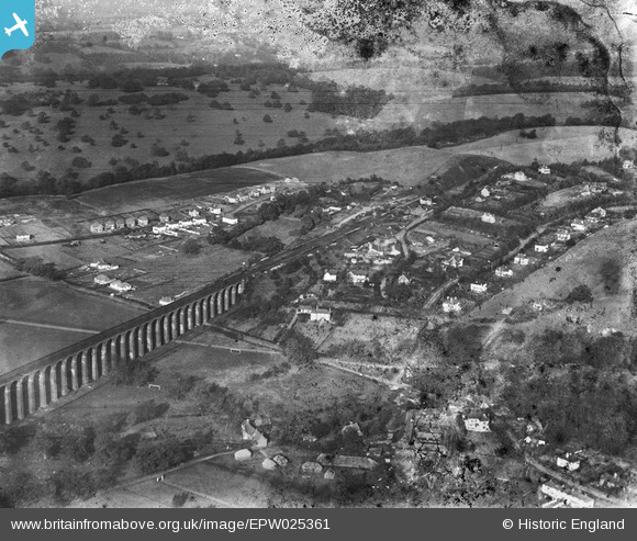
EPW025361 ENGLAND (1928). The Digswell Viaduct and High Welwyn, Digswell, 1928
© Copyright OpenStreetMap contributors and licensed by the OpenStreetMap Foundation. 2026. Cartography is licensed as CC BY-SA.
Nearby Images (4)
EPW025361

EPW054526

EPW062064

EPW062061

Details
| Title | [EPW025361] The Digswell Viaduct and High Welwyn, Digswell, 1928 |
| Reference | EPW025361 |
| Date | November-1928 |
| Link | |
| Place name | DIGSWELL |
| Parish | WELWYN |
| District | |
| Country | ENGLAND |
| Easting / Northing | 524642, 215207 |
| Longitude / Latitude | -0.19135372014946, 51.821120942004 |
| National Grid Reference | TL246152 |
Pins

Class31 |
Wednesday 11th of June 2014 04:14:18 PM | |

Chells809 |
Thursday 8th of November 2012 09:31:03 PM | |
|
Chells809 |
Thursday 8th of November 2012 09:29:29 PM | |
This would be the southern portal of the Welwyn South tunnel. |
John Wass |
Friday 9th of October 2015 07:44:27 PM |
|
Chells809 |
Thursday 8th of November 2012 09:28:18 PM |
