
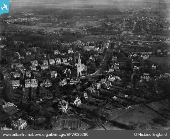
EPW025290 ENGLAND (1928). The Church of St Mary Magdalene, Windmill Hill and environs, Enfield, 1928. This image has been produced from a print.
© Copyright OpenStreetMap contributors and licensed by the OpenStreetMap Foundation. 2026. Cartography is licensed as CC BY-SA.
Nearby Images (4)
EPW025290

EPW010322

EPW001542

EPW010324A

Details
| Title | [EPW025290] The Church of St Mary Magdalene, Windmill Hill and environs, Enfield, 1928. This image has been produced from a print. |
| Reference | EPW025290 |
| Date | October-1928 |
| Link | |
| Place name | ENFIELD |
| Parish | |
| District | |
| Country | ENGLAND |
| Easting / Northing | 531744, 196743 |
| Longitude / Latitude | -0.095350081738451, 51.653552666123 |
| National Grid Reference | TQ317967 |
Pins
Be the first to add a comment to this image!