
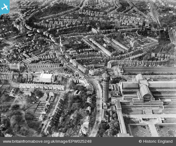
EPW025248 ENGLAND (1928). Crystal Palace South Tower, Anerley Hill and environs, Penge, from the south-east, 1928
© Copyright OpenStreetMap contributors and licensed by the OpenStreetMap Foundation. 2026. Cartography is licensed as CC BY-SA.
Nearby Images (10)
EPW025248

EPW052309

EAW000569

EPW052310

EPW025246

EPW021374

EPW025252

EPW021375

EPW025249

EPW052306

Details
| Title | [EPW025248] Crystal Palace South Tower, Anerley Hill and environs, Penge, from the south-east, 1928 |
| Reference | EPW025248 |
| Date | 25-October-1928 |
| Link | |
| Place name | PENGE |
| Parish | |
| District | |
| Country | ENGLAND |
| Easting / Northing | 533797, 170704 |
| Longitude / Latitude | -0.075585389593478, 51.419046133499 |
| National Grid Reference | TQ338707 |
Pins

Nowy Paul |
Sunday 18th of February 2018 04:13:47 PM | |
|
Nowy Paul |
Sunday 18th of February 2018 04:08:16 PM | |
|
Leslie B |
Sunday 13th of March 2016 01:22:35 PM | |
|
Mikey1304 |
Saturday 5th of March 2016 12:59:45 PM | |
|
John Wass |
Friday 26th of June 2015 03:23:27 PM | |
|
brianbeckett |
Monday 13th of October 2014 07:01:33 PM | |
|
Wordy |
Saturday 3rd of May 2014 11:02:58 PM | |

Alan McFaden |
Sunday 27th of October 2013 01:33:11 PM | |
|
MB |
Tuesday 5th of February 2013 10:59:03 AM | |
I think you're right. |
John Wass |
Sunday 24th of May 2015 04:18:12 PM |

User Comment Contributions
St.Francis Church, Gypsy Hill. |
Wordy |
Saturday 3rd of May 2014 11:00:46 PM |